The City of Austin owns and maintains at least 63 high hazard dam structures across the City. State and City dam safety criteria require these high hazard dams to be able to safely pass the Probable Maximum Flood (PMF) without failing. Our project team performed preliminary design assessments of the 63 dams to determine whether or not the dams were capable of safely passing the PMF, and if not, to perform preliminary designs of mitigation efforts to allow the dams to safely pass the PMF. Doucet provided the following services: Assisted in developing the hydrologic models for the 63 dams as part of the preliminary design services Calculated times of concentration for contributing runoff and developed HEC HMS models. Delineated drainage boundaries for each of the 63 structures based on available information and site visits Performed “peer review” of the proposed FNI methodologies for preliminary risk assessment from a theoretical breach and the overall structure ranking Provided input to the methodologies including technical publications on calculating breach width and breach side slopes, flowchart diagram to depict various evaluation steps, and a “sensitivity analysis” for dam breach velocity related to attenuation length Prepared memorandums summarizing the results of the peer review Under final design services, assisted the project team with developing hydrologic and hydraulic models for Pond Dams 26, 220, 267, 337, 581, and 726
SC Robertson Dam (Lake Limestone) and DeCordova Bend Dam (Lake Granbury) Breach Analyses and Inundation Mappings The Brazos River Authority (BRA) owns, operates and maintains a series of dams along the Brazos River. The dams have high-hazard classifications because of the consequences of dam failures, and because their sizes and hazard ratings are subject to State Dam Safety criteria. One of the dam safety criteria is that high-hazard dams must have written Emergency Action Plans with detailed supplemental breach inundation mappings. The BRA hired a preeminent hydrologic & hydraulic engineering firm to prepare the complicated breach analyses (using HEC-RAS hydraulic modeling) and detailed breach flood inundation mappings for S.C. Robertson Dam (Lake Limestone) and DeCordova Bend Dam (Lake Granbury) for “sunny-day” breach failure conditions and for Probable Maximum Flood (PMF) design flood conditions. S.C. Robertson Dam has a 8,130 foot-long embankment section with a maximum fill height of 60 feet, a concrete gravity spillway with 5 radial gates and a stilling basin. DeCordova Bend Dam has a 1,400 foot-long compacted fill embankment section with a maximum fill height of 63 feet, a concrete Ambursen-type spillway with 16 radial gates and a stilling basin. Breach analyses and breach flood inundation mappings were performed using HEC-RAS hydraulic program. Doucet calculated the breach parameters for both dams, the embankment sections, the gated spillway sections, the “sunny-day,” and for PMF design flood hydraulic conditions. Doucet performed data research of the configurations of the two dams, including reviews of the construction as-built drawings and performed site visits to confirm field conditions and to confirm the locations and types of reasonable breach scenarios.

Scenic Brook Flood Control Project, Hydrologic Modeling & Dam Hazard Analysis The Scenic Brook neighborhood is located on the Scenic Brook Tributary to Williamson Creek in the City of Austin. The neighborhood has been plagued by frequent local flooding. The City hired a team to develop mitigation measures. As part of the solution, the team identified a stormwater detention pond up gradient from South Brook Drive to reduce peak flowrates entering the neighborhood. Doucet provided the following: Developed the SCS TR-20 model for the existing and future condition for the 2-, 5-, 10-, 25-, and 100-year storms Coordinated with TCEQ staff on dam safety requirements. Coordinated with staff in adjusting detention pond outlet structures to meet flood control objectives and TCEQ requirements. The detention pond consisted of a concrete retaining wall embankment, and is approximately 16’ high with a flood storage volume of about 22 acre-feet. Developed dam safety analysis using the Probable Maximum Flood (PMF) storm event Prepared engineering report documenting the project approach and conclusions.

34th Street Reconstruction from West Ave to Shoal Creek Bridge Drainage Analysis and Storm Drain Improvements Doucet provided preliminary and final designs of the storm drain improvements for the reconstruction of 34th Street from West Avenue to the Shoal Creek Bridge, a distance of approximately 2,170 ft. Our designs included the following: Design of approximately 1,950 LF of storm drain conduits (ranging from 18-inch RCP to 7’x4’ box culverts) A final design of the storm drain system improvements including coordination of horizontal and vertical alignments of the storm drain conduits with water and wastewater relocations, pavement reconstructions, and structural designs of the impact basin and retaining wall at Shoal Creek. Innovative combinations of storm drain conduit sizes, pipe classes, and alignments were used to minimize utility conflicts and relocations and to allow tunneling under Lamar Boulevard to install the 48” storm drain line without disrupting Lamar Boulevard traffic

Bull Creek Watershed Floodplain Modeling and Mapping The Bull Creek Watershed, including West Bull Creek, is a suburban watershed with approximately 31.5 square miles of drainage area and 34.25 stream miles to be studied. The main purpose of this project was to develop digital geo-referenced hydrologic and hydraulic models and floodplain maps for the Bull and West Bull Creek watersheds for both existing and fully-developed land-use conditions. Our responsibility for this project involved developing hydraulic data and floodplain mapping for selected tributaries of Bull Creek. Doucet developed: Fully-annotated HEC-RAS models with all supportive GIS files such as cross-sections and GIS geodatabase for both existing and fully-developed land-use conditions Digital hydraulic data including tables, methodology descriptions and exhibits for Existing and Fully-Developed Land-use Conditions to incorporate into the Hydraulic Technical Support Data Notebooks (TSDN), Water surface elevation profiles at similar vertical and horizontal scale as the profiles in the effective FIS report for selected FEMA flood frequencies using RAS-PLOT for the detailed study tributaries only, Floodplain mapping Digital copies of the floodplains and BFEs for the detailed study tributaries for both existing and fully-developed land-use conditions

Over 175 homes located in the Crystal Brook neighborhood were threatened by frequent flooding due to floor elevations below the 100-year storm water surface elevations. Doucet provided the following improvements: 16,600 LF of storm sewer lines (ranging from 18” RCP to 12’ x 7’ concrete box) 7,000 LF of channel improvements (ranging from 6’ wide to 100’ wide bottom) 5,700 ft. flood barrier system 2,000 LFof creek bank stabilization and restoration

Los Indios Culvert Upgrade and Channel Improvements The Los Indios subdivision and Los Indios Trail are located in northwest Austin. The Los Indios Trail roadway was overtopped by Rattan Creek during the 10-year and greater return period storm events putting seven (7) homes in the vicinity of Los Indios Trail at risk of flooding in the 100-year storm event. Using on-the-ground topographic survey, Doucet developed alternatives to mitigate the culvert and local flooding problems and prepared construction plans for the proposed improvements.

Doucet performed a hydrologic and hydraulic study of the existing storm drain network in the lower Fort Branch Oak Lawn Subdivision area bounded by Springdale, Heflin, Webberville, and Ribecke roads. This area was identified as having localized flooding problems through the Fort Branch Watershed Integrated Solutions Study. As a result, new storm drain systems were designed to supplement the existing systems. The final design encompassed approximately 5,500 LF of storm drain pipe and 2,000 LF of water main.
Over 100 linear feet of existing 36” diameter concrete wastewater line lost the cover and backfill due to scour and downcutting of Country Club Creek just upstream of Grove Boulevard. The line was downstream of the Austin Community College Riverside Campus and many apartment complexes. The exposed line was vulnerable to being deflected with opening pipe joints and wastewater spills if not stabilized. We designed a stabilized riffle downstream of the problem area to stable upstream environment for the new backfill around the exposed wastewater line. To stabilize the exposed wastewater line, an external gasket was used at each joint. The final design included normal bedding for the pipeline to the haunch, rock ballast to the top of the pipe and top it off with 12” diameter rock riprap.
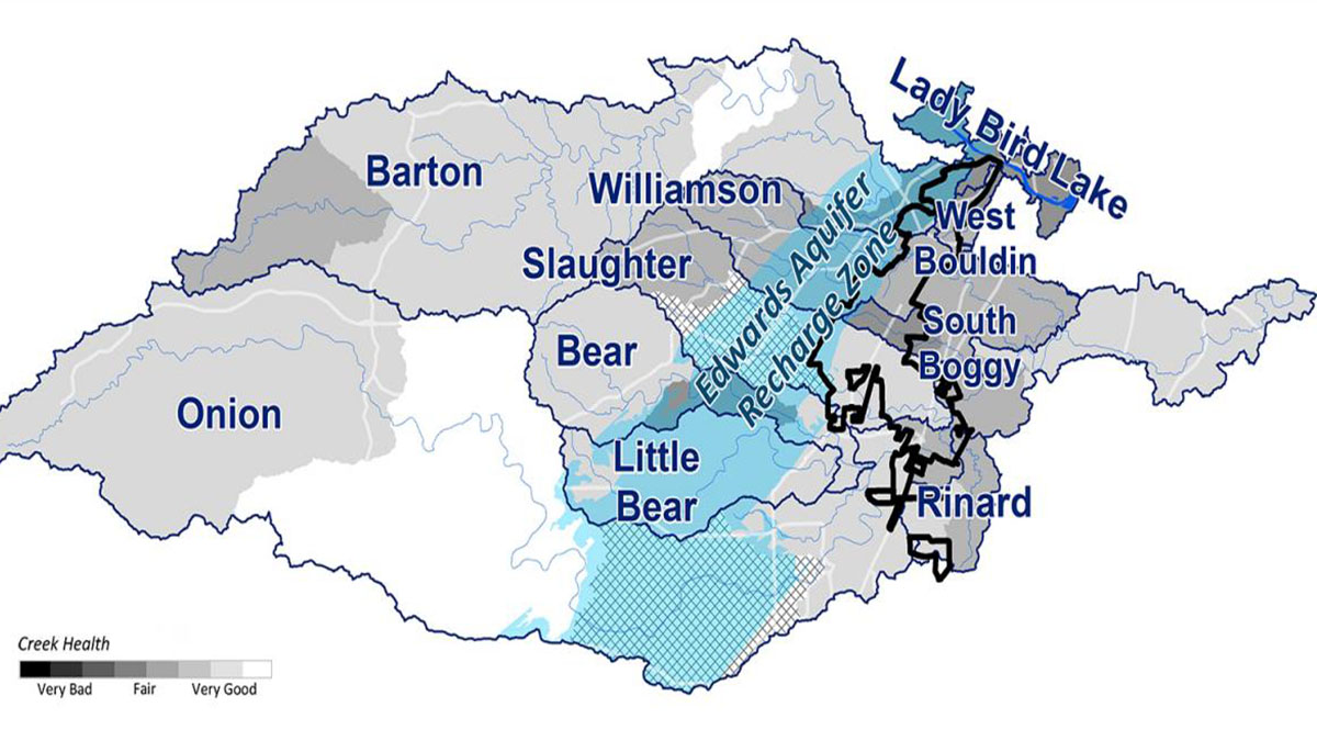
Most of the Austin’s watersheds, including urban and suburban watersheds, are drained by streams that exhibit existing creek bank erosion problems and have the potential for future creek bank degradation. The concern for future creek bank failures, long term channel degradation, and their impact to creekside residents and water quality initiated the City of Austin Drainage Utility Department to authorize the city wide watershed erosion assessments in January 1997. The 17 watersheds are as follows: Barton Creek Watershed Blunn Creek Watershed Boggy Creek Watershed Bull Creek Watershed Buttermilk Creek Watershed Country Club Creek Watershed East Bouldin Creek Watershed Fort Branch of Boggy Creek Watershed Johnson Creek Watershed Little Walnut Creek Watershed Shoal Creek Watershed Tannehill Branch of Boggy Creek Watershed Waller Creek Watershed West Bouldin Creek Watershed Walnut Creek Watershed Williamson Creek Watershed
Doucet prepared “natural channel” design which incorporated floodplain creation and bioengineering to maintain bed load transport and flow conveyance in a stable channel system.

Doucet stabilized the stream banks and maintained bed load transport. Different techniques such as geogrid, large boulders, erosion fabrics, and bioengineering were employed to manage the channel erosion while creating a natural channel appearance.

The Shoal Creek hike and bike trail experienced erosion problems in the lower reaches of Shoal Creek, often completely washing the trail out at some locations along the top of the channel banks. The project designed solutions for nine separate erosion locations along Shoal Creek in the area from 6th Street to 29th street. Nine areas were selected for improvements and were developed using varying techniques such as limestone boulders with geogrid for stability, erosion matting, permeable concrete for trails, and bioengineering were employed to manage erosion of the trails while creating a natural appearance for the channel.

Construction of 7.3 miles of Southern Walnut Creek Bike Trail. The trail is aligned close to the Walnut Creek and Boggy Creek channels where ongoing channel instability and erosion could undermine the new trail. CPE designed Walnut Creek and Boggy Creek channel stabilization measures at four locations, emphasizing the use of green channel stabilization measures, rather than traditional “hard” measures, including 520 CY of gabions, 1,800 SY of soil retention blanket, 3,400 SY of geogrids, 2,840 CY of rock riprap, and 220 CY of large limestone blocks.

Doucet assisted in the development of a master plan within the Waller Creek corridor the Waller Creek District. The master plan’s project area was generally bound by: 12th Street on the north; Interstate Highway 35 on the east; Lady Bird Lake on the south; and Red River street and Trinity Street on the west. One goal of this project was to provide strategies and costs for the restoration of eroded and otherwise degraded sections of Waller Creek stream banks within the study area. Doucet was responsible for budget estimates for all of the creek corridor improvements. Improvements included adding trails, stairs, ramps, terraces, overlooks, path lighting and the removal of obstructions and dams. Doucet also presented the Creek Corridor Comparable Projects Report and Budget Estimate to City of Austin staff and the Technical Advisory Group for their review and comment. Doucet also performed field reconnaissance visits to confirm existing conditions and to identify locations and to make measurements of stream channel improvements.

Whitaker Field at Waller Creek Stream Bank Stabilization Doucet provided bank stabilization services for three of the most severely eroded areas along the west bank of Waller Creek within the University of Texas Whitaker Field property boundary as well as preparation of a Master Erosion Plan for the Waller Creek along Whitaker Field. The existing Waller Creek was characterized by bank erosion, channel bottom down cutting, fallen tree trunks and limbs, significant amount of debris, significant amount of trees, and frequent wastewater line crossings. The University of Texas was losing property and the eroded bank was a potential safety hazard for the athletic field users. To correct this, Doucet used stabilization techniques for the three most severely eroded areas that included placing limestone blocks, selected soil backfill, soil retention blankets and 2’ diameter rock riprap at the problem areas. The City’s Austin Clean Water Program (ACWP) has a wastewater improvement project along a portion of the study area. Doucet coordinated with the ACWP director and project engineer to insure a seamless transition between the two projects. Towards this goal, Doucet assisted the project engineer in creating a Master Erosion Plan which included reviewing of peak discharges, channel velocities and shear, as well as identifying additional bank stabilization areas and locations of grade control structures. The Master Erosion Plan was presented to the representatives from the UT Athletic Department and was well received.

Downtown Overlay District (DOD), Water Quality Master Plan and Regional Water Quality Pond Design The City of Georgetown developed a downtown master plan to provide a comprehensive development strategy for the central part of the City. The master plan boundary followed that of the Downtown Overlay District (DOD). The DOD, comprised of approximately 110 acres, consisted of varied land uses including commercial, institutional, and residential. As part of the downtown master plan and to provide a more holistic approach toward re-development within the DOD, the City investigated a “regional” approach to providing storm water quality management. Utilizing such an approach eliminated the need for individual water quality ponds on each re-developing parcel, allowing more flexibility in design and providing a more aesthetically pleasing framework for this historic area of the city.

The La Frontera Section I and II development (a 113-acre commercial retail center) is located at the Northwest corner of IH-35 and FM 1325 in Round Rock, Texas. Doucet designed a regional stormwater detention facility to protect downstream properties (structures within the floodplain), and a stormwater quality treatment facility to protect the northern Edwards’ Aquifer. In addition, three downstream road crossings were sub-standard and did not allow for safe passage in a 25-year storm event. Doucet performed a hydrologic analysis on this tributary of Lake Creek and designed culvert improvements for the three road crossings.

The Town Lake Park water quality wet pond is located in the northwest quadrant of the Palmer Events Center. The pond collects, treats, and detains stormwater runoff from approximately 18.3 acres of the site which includes the following areas: Palmer Community Events Center building (rooftop runoff), parking garage, parking and drive area near the Doherty Arts Center, the children’s outdoor arts center, the open meadow inside the large oval sidewalk, and the area in the immediate vicinity of the pond.

Identified as public land (approx 16 acres) within the West Bouldin Creek watershed, Doucet provided water quality, erosion control, and low storm intensity flood control to the creek and riparian corridor. The Best Management Practices (BMP) consisted of a channel runoff diversion structure, a sedimentation/extended detention pond, and a downstream level spreader with a ½-acre vegetative filter strip prior to discharging flow back into West Bouldin Creek

Working with the Parks and Recreation Department, Doucet provided engineering services for a previous landfill site bounded by Town Lake to the north, Mopac Expressway to the east, Stratford Drive to the south, and Eanes Creek to the west. Doucet performed the following: Hydrologic & Hydraulic Analysis for the contributing drainage area upstream of the project site Channel Improvements Design to convey runoff using 6” Conlock with vegetation infill and covered with biodegradable soil retention blankets Liner System Design using Geomembrane EPDM Rubber Liner for the new channel Bank Stabilization development using vegetated reinforced soils, vegetation planting, soil retention blanket, rock riprap, limestone blocks and AKWARDRAIN for Eanes Creek.